New program to monitor glacier change at Glacier National Park, others
-
Share on Facebook
-
Share on Bluesky
-
Share on X
- Copy Link
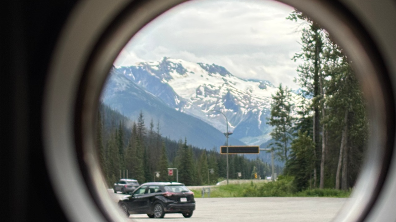
A new federal program will see members of the public help track glacier levels at several parks in B.C. and across Canada.
The Icy Initiative will see cell phone stands set up at select parks for people to take and submit their photos to the GeoReach website to help track snow levels and their changes, such as retreat, thinning, and disappearance.
“In this UN International Year of Glaciers’ Preservation, our government and Parks Canada are proud to invite Canadians to connect with the beauty and power of the iconic glaciers we are so fortunate to have in Canada,” Steven Guilbeault Minister of Canadian Identity and Culture and Minister responsible for Official Languages, stated.
“Through the Icy Initiative, visitors become part of the story — helping us understand and protect these precious natural wonders in the face of climate change. Our government has committed to protecting more nature than ever before, and it is by acting collectively that we can achieve our conservation goals and protect what makes us strong. I encourage everyone to take part to this initiative and submit their best shot of a glacier when visiting one of the participating parks!”