
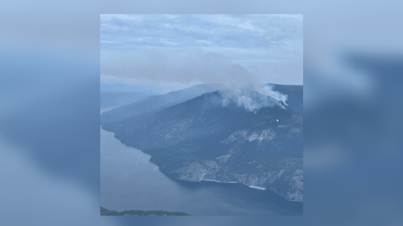
Smoke from the Lower East Adams Lake wildfire (photo courtesy of the Columbia Shuswap Regional District / B.C. Wildfire Service)
Wind direction helping
Progress being made on the Lower East Adams Lake wildfire
Jul 21, 2023 | 3:51 PM
-
Share on Facebook
-
Share on Bluesky
-
Share on X
- Copy Link
A shift in wind direction is helping firefighters battling the now 219-hectare Lower East Adams Lake Wildfire.
The Shuswap Emergency Program remains in close contact with the BC Wildfire Service regarding the Lower East Adams Lake wildfire burning near the communities of Enns Reach, Woolford Point and Dorian Bay.
The Evacuation Alerts issued last evening by the Columbia Shuswap Regional District (CSRD), the Thompson Nicola Regional District (TNRD) and The Adams Lake Indian Band (ALIB) all remain active. Property owners should be prepared to leave on short notice, if necessary.
- Fire growth continues to be towards the north, away from the populated area.
- The forecasted winds are also favourable, as they are predicted to push the fire growth north, away from structures.
- The fire is burning in steep terrain, which is making accessibility a challenge.
- Helicopter support is being used on the south flank of the fire. This will help keep the area wet and cool and reduce any fire movement down the slope towards the populated areas.
- The fire is approximately 2.3 kilometres from the closest structure.
- Today’s mapping of the fire shows it has grown to approximately 219 hectares. The fire was mapped yesterday at 70 hectares. This measurement was likely an underestimate, as smoke was obscuring much of the area.
- CSRD FireSmart personnel have gone to the area to advise property owners on ways they can reduce the wildfire risk to their homes or cabins.


