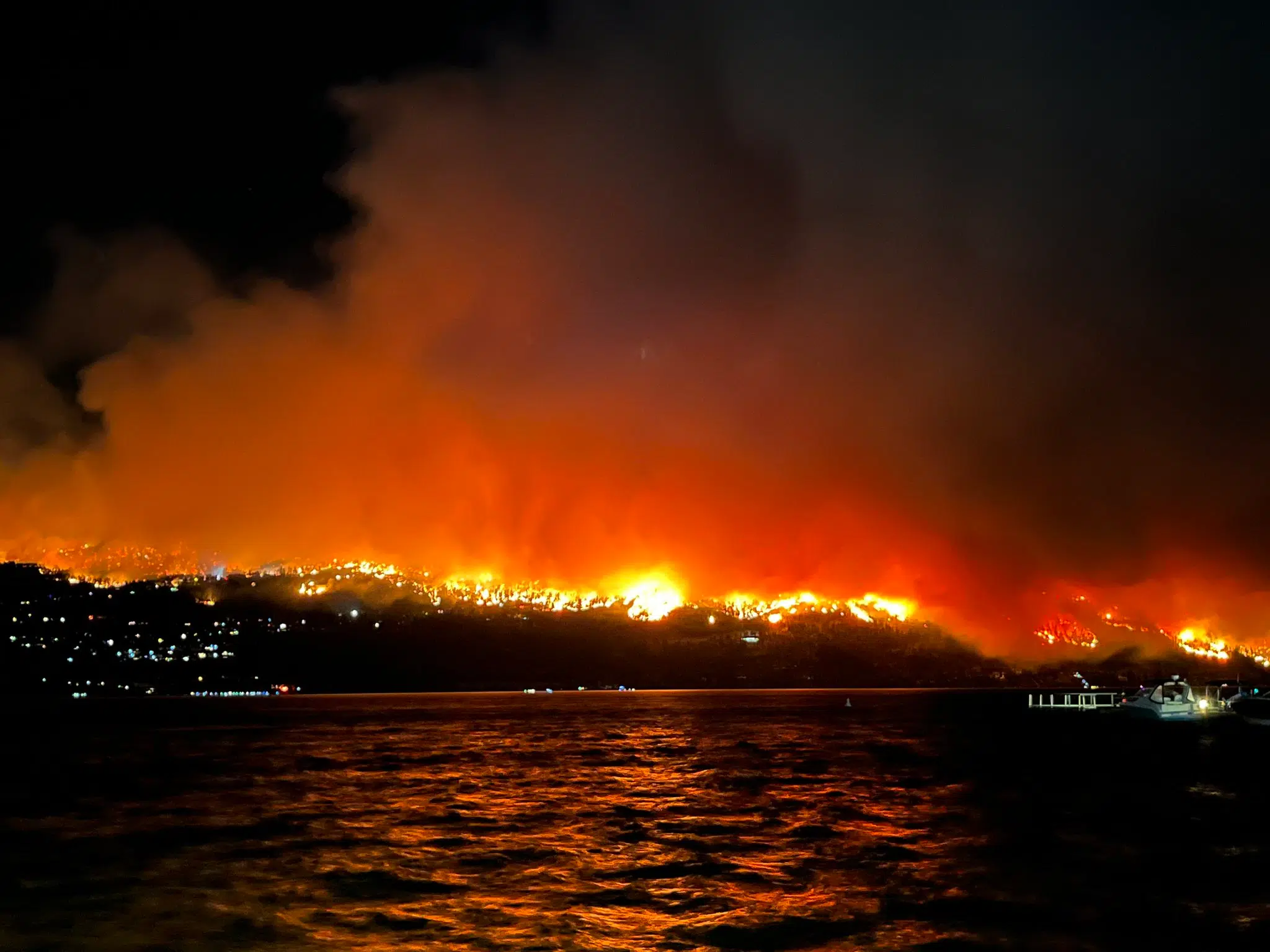
(Photo credit: Britt Filion/X)
Okanagan

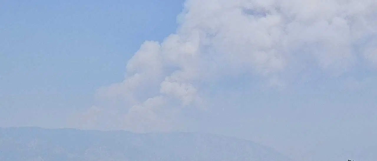
UPDATE: ‘Significant structural loss’ from McDougall Creek fire, 2,400 properties on evacuation order, grows to 6,800 ha.

Aug 18, 2023 | 10:45 AM

UPDATE: 10:30 p.m.

Officials are saying there was “significant structural loss” overnight due to the McDougall Creek wildfire near West Kelowna.

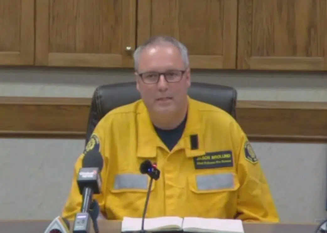
Loyal Wooldridge, chair of the Regional District of Central Okanagan, told a news conference in Kelowna the number of structures damaged will be assessed over the coming days, but some of the  damage was in the Trader’s Cove area of RDCO and on Bear Creek Road in West Kelowna.

Wooldridge said there has been no loss of life that they are aware of.

He thanked fire crews for their efforts, saying they did everything they could to prevent structure damage.

“However, at the end of the day, the force of Mother Nature has proved to be too much,” he said.

Reports have confirmed that the Lake Okanagan Resort on Westside Road was among the buildings consumed.

West Kelowna fire chief Jason Brolund was emotional as he spoke at the news conference.

“It was a devastating night last night, probably one of the toughest of my career,” the chief said. “We fought 100 years of fires, all in one night.”

West Kelowna fire chief Jason Brolund at news conference. (submitted photo)

Brolund didn’t have an estimated number of structures lost after one reporter suggested it may have been as many as 80.

He said some emergency responders were trapped by the fire, as they went in to rescue people who had chosen not to evacuate.

“That’s a fire chief’s worst nightmare.”

Brolund added some people were rescued in the water at Trader’s Cove.

Brolund said they expected the fire to be bad on Thursday, but said it turned out be “exponentially worse” than what they expected.

He said today could be another “scary night” with more wind in the forecast.

“Don’t panic. We’ve got a great team here. We’re going to get this thing,” the fire chief said.

Kelowna fire chief Travis Whiting said it appears several fires that ignited in Kelowna’s Clifton/McKinley areas overnight appeared to be spotting fires from flying embers, but added that hasn’t been confirmed.

He said there has been no structures damaged in Kelowna from those fires.

Chief Brolund said they’ve had great support from BC Wildfire and the RCMP who knocked on “thousands of doors” Thursday night for evacuations

He said fire departments from Kamloops, Comox, Lake Cowichan, Kelowna and Enderby were among those on hand, helping fight the fire.

“All working alongside each other. Even though they had just met each other, they were digging in and saving houses and it was very powerful.”

UPDATE: 9 a.m.

The BC Wildfire Service says the updated size of the McDougall Creek wildfire is 6,800 hectares, a big jump from the 1,100 hectares on Thursday night.

The Central Okanagan Emergency Operation Centre will provide a news conference and online streaming update for media about active fires in the region.

Representatives from local fire services, BC Wildfire Service, Interior Health and other agencies will be providing information.

A question and answer session will follow.

The event will be at 10:30 a.m. today (Aug. 18) at the RDCO office 1450 KLO Road

Update 8:50 a.m.

More properties on the west side of Okanagan Lake have been issued evacuation orders due to the McDohugal Creek wildfire.

Central Okanagan Emergency said properties north of Nahun to, but not including, La Casa are now under Evacuation Order.

Residents on Evacuation Order must leave the area immediately.

To ensure an orderly evacuation in these areas, please follow directions from emergency personnel. Public safety and the protection of critical infrastructure are the primary concerns at this time.

Evacuees should register online at https://ess.gov.bc.ca or attend the Information Centre at Kal Tire Place located at 3445 43rd Ave in Vernon.

UPDATE: 2:30 a.m.

Officials are confirming some structures have been lost due to the McDougall Creek wildfire which has been very active and unpredictable.

A full assessment of the areas affected will be undertaken in the morning.

A detailed update will be provided at 10am on Friday, August 18, 2023 by Emergency Officials. Log-in information for the livestreamed event will be posted on cordemergency.ca.

Currently 2,462 properties are under Evacuation Order and 4,801 properties are under evacuation alert for the McDougall Creek Wildfire.

All current orders and alerts remain in place and the public are reminded to stay out of the evacuation area as they are active fire zones. As per Transport Canada, drones are prohibited from flying over a forest fire area or any area located within five nautical miles of a forest fire area.

Evacuees should register online at https://ess.gov.bc.ca. Evacuees are encouraged to find temporary lodging with family and friends.

All reception centres in West Kelowna, Kelowna and Vernon have closed for the evening. An overnight shelter centre has opened at Prospera Place, 1223 Water Street, Kelowna for evacuees requiring a place to go overnight. Small pets caged or leashed are permitted.

ESS will be available to evacuees in the morning to assist with registrations.

Residents can refer to the interactive map on cordemergency.ca to search by street address to determine if you are affected by active orders or alerts.

Residents under Evacuation Alert are advised to be ready to leave their home at a moment’s notice. They should prepare to be away from their home for an extended period of time, make arrangements for pets and pack essential items such as medicines and important documents.

Emergency Operations Centre staff are working with other response agencies to manage the situation and minimize the impacts. Public safety and the safety of emergency response personnel are the primary concerns at this time.

Emergency response personnel request that:

Those on evacuation alert pre-register at https://ess.gov.bc.ca/ ahead of time for Emergency Support Services should an Evacuation Order be declared.
The public avoid the Evacuation Alert areas so emergency responders can effectively perform their duties
Please only call 911 in case of emergency
For up-to-date information on the situation, including a map, and to sign up for e-updates, visit cordemergency.ca. Information will also be provided via twitter.com/CO_Emerg and facebook.com/CORDEmergency.

For more information, contact the information line at 250-469-8490 (local) or 1-877-569-8490 (toll-free).

UPDATE: 9:10 p.m.
McDougall Creek fire expands to 1,100 hectares, more evacuations

All properties along Westside Road from Traders Cove to Nahun are now under evacuation order due the McDougall Creek Wildfire.

The evacuation alert zone has expanded north to Killiney Beach.

Recently added properties under Evacuation Order all properties accessed off Westside Rd North of Traders Cove to Nahun, including:

Bancroft Rd
Banff Rd
Blair Rd
Bolton Rd
Browse Rd
Deighton Rd
Denison Rd
Jenny Creek Rd
Shelter Cove
Westside Pl
All properties within Okanagan Lake Resort

Residents on Evacuation Order must leave the area immediately and evacuate northward on Westside Road towards Vernon.

Due to unpredictable fire behaviour, it is critical that all residents evacuate for their safety and the safety of first responders in the area.

All remaining properties in the Rose Valley neighbourhood north of Stevens Road, and West Kelowna Estates, are also now under Evacuation Order.

As well, the Evacuation Alert area has been expanded to include the following properties on Westbank First Nation IR 10 lands:

Lindley Dr

Waters Edge Lane

Harbour Green Rd

Lake Breeze Rd

Crest Ridge Lane

Marina Way

Beach View Lane

Lake Vista Rd

Viewpoint Dr

Viewpoint Crt

Harbour View Blvd

Old Ferry Wharf Rd

Ariva Dr

Nancee Way Crt

Theresa Pl

Gerald Pl

Tees Pl

Spland Rd

Katherine Rd

Ha’ustkt’ Pl

Evacuees should register online at https://ess.gov.bc.ca or attend the Information Centre at Kal Tire Place, 3445 43rd Avenue in Vernon.

Residents can refer to the interactive map on cordemergency.ca to search by street address to determine if you are affected.

All other properties on evacuation alert and order for the McDougall Creek Wildfire remain in place.

UPDATE: 7:10 p.m.

More homes have been added to the evacuation orders for the McDougall Creek wildfire which is now estimated at 1,100 hectares.

That’s significant growth to the 300 hectares reported around 11 a.m. this morning for the fire burning about 10 km’s northwest of West Kelowna.

Click here for the latest from the BC Wildfire Service.

Central Okanagan Emergency says all properties in Sailview Bay, Raymer Bay, Bear Creek Provincial Park and Traders Cove are now under Evacuation Order.

Recently added properties under Evacuation Order include:

All properties along Westside Road from Bear Creek Forest Service Road South to Westbank First Nation IR#10, including:

1 – 386 Westside Rd
Traders Cove Rd
Siemens Rd
Edith Crt
Heldon Crt
Sailview Bay

Residents on Evacuation Order must leave the area immediately. To ensure an orderly evacuation in these areas, please follow directions from emergency personnel. Public safety and the protection of critical infrastructure are the primary concerns at this time.

Evacuees should register online at https://ess.gov.bc.ca and attend the Information Centre at Royal LePage Place, 2760 Cameron Road in West Kelowna.

Residents can refer to the interactive map on cordemergency.ca to search by street address to determine if you are affected.

All other properties on evacuation alert and order remain in place.

Those on evacuation alert pre-register at https://ess.gov.bc.ca/ ahead of time for Emergency Support Services should an Evacuation Order be declared.

The public avoid the Evacuation Alert areas so emergency responders can effectively perform their duties

Please only call 911 in case of emergency

For up-to-date information on the situation, including a map, and to sign up for e-updates, visit cordemergency.ca. Information will also be provided via twitter.com/CO_Emerg and facebook.com/CORDEmergency.

UPDATE 5:40 p.m.
Another 800 properties ordered out due to McDougall Creek fire

Another 800 properties have been placed on evacuation of the orders due to the McDougall Creek wildfire northwest of West Kelowna.

Of that total, 143 properties are in the Bartley Road area and 620 are in the Rose Valley area of West Kelowna

Tactical evacuations began around 5 p.m.

Recently added properties under Evacuation Order include all properties on Bartley Road north of Shannon Lake Road including:Lenz Road

1620 Stevens Road
1830 Shannon Lake Road

All of the Rose Valley subdivision was also recently added to the Evacuation Order area including:

Roseridge Crt
Rosewood Dr
Rosealee Lane
Jok Mar Crt
Rosewood Crt
Rosemary Crt
Roseabby Dr
Rosefield Dr
Rosealee Crt
Rose Meadow Dr
Rose Hill Pl
Rose Anne Crt
Rose Tree Rd

Areas north of Westlake Rd and Parkinson Rd were also recently added to the Evacuation Order area including:

Pettman Rd
Bowes Rd
Blackwood Dr
Klein Rd
Guest Rd
Valois Crt
McPhail Crt

Residents on Evacuation Order must leave the area immediately. To ensure an orderly evacuation of these areas, please follow directions from emergency personnel. Public safety and the protection of critical infrastructure are the primary concerns.

Evacuees should register online at https://ess.gov.bc.ca or attend the Information Centre at Royal LePage Place, 2760 Cameron Road in West Kelowna.

Evacuees are encouraged to connect with friends and family for temporary accommodations. Those unable to find local accommodations can visit the ESS Reception Centre to access group lodging.

Residents can refer to the interactive map on cordemergency.ca to search by street address to determine if you are affected.

All other properties on evacuation alert and order remain in place.

UPDATE: 1:30 p.m.
Evacuation orders and more alerts issued for McDougall Creek fire

A local state of emergency has been issued for the City of West Kelowna, a portion of Westbank First Nation and the Central Okanagan West Electoral Area due to the growing McDougall Creek wildfire.

The fire is currently estimated at 300 hectares and is classified as out of control.

An evacuation order has been issued for 68 properties formerly on alert. The order affects all properties accessed off of Bear Creek Road to the north of Parkinson Road (not including Parkinson Road).

A map of properties under Alert and Order can be found at cordemergency.ca or search by street address on the interactive map to determine if you are affected.

“Residents on evacuation order must leave the area immediately. To ensure an orderly evacuation of residents in these areas, please follow directions from emergency personnel. Public safety and the protection of critical infrastructure are the primary concerns at this time,” a news release from Central Okanagan Emergency stated.

Properties affected by the evacuation order include:

Dougmac Road
Petterson Road
Rose Valley Road
1045 Bear Creek Road2740 Smith Creek Road
2850 Dixie Road
1075 Bear Creek Road
495 Bear Creek Road
525 Bear Creek Road
551 Bear Creek Road
573 Bear Creek Road
611 Bear Creek Road
674 Bear Creek Road
724 Bear Creek Road
779 Bear Creek Road
875 Bear Creek Road
944 Bear Creek Road

Evacuation alerts have also been expanded to include areas north of Traders Cove up to and including Caesars Landing.

Residents must be ready to leave their home at a moment’s notice and be prepared to be away from their home for an extended period of time. Get ready and make arrangements for pets and livestock and pack essential items such as medicines and important documents.

More than 5,700 properties have been placed on evacuation alert in the following communities:

Bartley Road
Bear Creek Provincial Park
Caesars Landing
Pine Point
Raymer Bay
Rose Valley
Sailview Bay
Shannon Woods
Smith Creek
Tallus Ridge
Traders Cove
West Kelowna Estates
West Kelowna Industrial and Business Park
Wilsons Landing
Portions of Westbank First Nation IR#9
Portions of Westbank First Nation IR#10
Portions of the Central Okanagan West Electoral Area south of Bear Creek Main Forest Service Road, including the Bear Creek Off-Highway Vehicle Recreation Site

Due to the number of properties under Alert and Order, refer to the interactive map on cordemergency.ca to search by street address to determine if you are affected.

Bear Creek Provincial Park is also under an Evacuation Alert and campers are advised to be ready to leave the area. Recreation areas within West Kelowna and Central Okanagan West Electoral Area are under Evacuation Order and the public is asked to leave the area immediately.

Evacuees should register online at https://ess.gov.bc.ca/ or attend the Information Centre at Royal LePage Place, 2760 Cameron Road in West Kelowna.

If you are evacuating, please connect with friends and family for options for temporary accommodations as tourism partners are at capacity.

A public information line is available at 250-469-8490 (local) or 1-877-569-8490 (toll-free)

Weather alerts issued by Environment Canada are advising of gusty winds today and overnight Friday may worsen wildfire conditions and possible new fire starts.

For up-to-date information on the situation, including a map, and to sign up for e-updates, visit cordemergency.ca. Information will also be provided via twitter.com/CO_Emerg and facebook.com/CORDEmergency.

==

Update: 11 a.m.
McDougall Creek fire grows to 300 hectares

The McDougall Creek wildfire northwest of West Kelowna is now estimated at 300 hectares in size, up from the earlier 64 hectares.

Reports on flightaware.com say as many as 12 aircraft are working the fire site, including some skimmers picking up water from Okanagan Lake.

No new evacuation alerts or orders have been issued so far.

More than 4,800 properties in West Kelowna, Westbank First Nation and the Regional District of Central Okanagan were put on evacuation alert Wednesday night.

McDougall Creek fire (Photo credit: Russ Byth)

Click here for more on the fire from the BC Wildfire Service.

Update 10 a.m.
4,800 under evacuation alert due to McDougall Creek fire

More than 4,800 properties in the Regional District of Central Okanagan (RDCO) are on evacuation alert due to the McDougall Creek fire, which is burning 10 km’s northwest of West Kelowna.

The notice was issued late Wednesday night and means residents have to be ready to leave their homes at a moment’s notice and could be displaced for an extended period of time.

It covers residents in portions of West Kelowna, Westbank First Nation and part of the Central Okanagan West Electoral Area.

For the full list of evacuation alerts and up-to-date information on the situation, visit cordemergency.ca.

The BC Wildfire Service the fire displayed significant fire behaviour Wednesday and is now estimated to be 64 hectares and is classified as out of control.

It is highly visible from West Kelowna and surrounding areas.

Out of an abundance of caution, the Regional District of Central Okanagan closed four regional parks in the evacuation alert zone for the McDougall Creek Wildfire. The closed parks include:

Traders Cover Regional Park
Raymer Bay Regional Park
Rose Valley Regional Park
Upper Glen Canyon Regional Park from lower Glenrosa to Smith Creek

The closures were put in place to protect public safety and to limit the number of people in the evacuation alert area. Residents are asked to respect signage, watch for barricades and stay out of the parks until further notice.

The CORD Emergency e-news update system to subscribers experienced technical issues Wednesday night and staff have remedied the situation. Residents are encouraged to subscribe to e-news updates at cordemergency.ca.

==

4,800 under evacuation alert due to fire northwest of West Kelowna

The Emergency Operations Centre has been activated to support BC Wildfire Service for the McDougall Creek Wildfire, located approximately 10 kilometres northwest of West Kelowna.

Evacuation alerts are in effect for portions of West Kelowna, Westbank First Nation and a portion of the Central Okanagan West Electoral Area.

Residents in the area are advised to be ready to leave their home at a moment’s notice. They should be prepared to be away from their home for an extended period of time, make arrangements for pets and pack essential items such as medicines and important documents.

Up to 4,800 properties have been placed on Evacuation Alert in the following communities:

·         Bartley Road

·         Bear Creek Provincial Park

·         Pine Point

·         Raymer Bay

·         Rose Valley

·         Sailview Bay

·         Shannon Woods

·         Smith Creek

·         Tallus Ridge

·         Traders Cove

·         West Kelowna Estates

·         West Kelowna Industrial and Business Park

·         Portions of Westbank First Nation IR#9

·         Portions of Westbank First Nation IR#10

·         Portions of the Central Okanagan West Electoral Area south of Bear Creek Main Forest Service Road, including the Bear Creek Off-Highway Vehicle Recreation Site

Due to the number of properties under Alert, refer to the interactive map on cordemergency.ca to search by street address to determine if you are affected.

Bear Creek Provincial Park is also under an Evacuation Alert and campers are advised that the area is an active wildfire zone and be ready to leave the area. Recreation users are advised to avoid the Alert areas within the West Kelowna and Central Okanagan West Electoral Area until further notice.

The BC Wildfire Service is continuing to respond to the McDougall Creek wildfire, which is estimated to be 64 hectares and is highly visible from West Kelowna and surrounding areas.

Weather alerts issued by Environment Canada are advising of gusty winds Thursday and overnight Friday may worsen wildfire conditions and possible new fire starts.

The Emergency Operations Centre is working with other response agencies to manage the situation, however, residents of the area should be prepared to obey an Evacuation Order if needed. An evaluation of the situation is underway and specific details will be released as they are confirmed. Public safety and the protection of critical infrastructure are the primary concerns at this time.

Emergency response personnel request that the general public:

Pre-register at https://ess.gov.bc.ca/ ahead of time for Emergency Support Services should an Evacuation Order be declared.
Avoid the Evacuation Alert areas so emergency responders can effectively perform their duties
Please only call 911 in case of emergency

For up-to-date information on the situation, including a map, and to sign up for e-updates, visit cordemergency.ca. Information will also be provided via twitter.com/CO_Emerg and facebook.com/CORDEmergency.

BC Wildfire Service will provide an update August 17 mid-morning and the EOC will issue further updates when more information is available. For more information, contact the information line at 250-469-8490 (local) or 1-877-569-8490 (toll-free).

For municipal and local government information such as boat launch, park and road closures, visit their websites:

City of West Kelowna
Regional District of Central Okanagan
Westbank First Nation

Motorists considering travelling on Highway 97 and Westside Road visit drivebc.ca for up-to-date road closures information.

View Comments