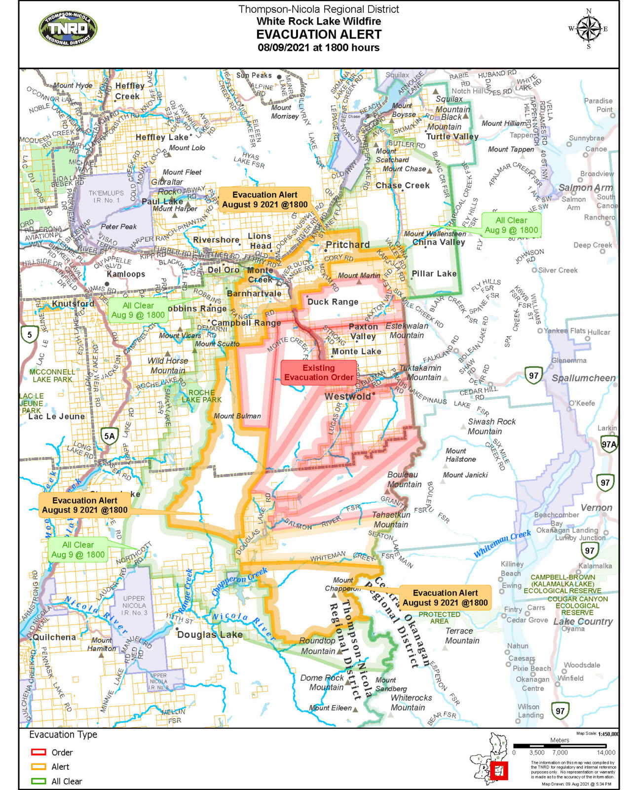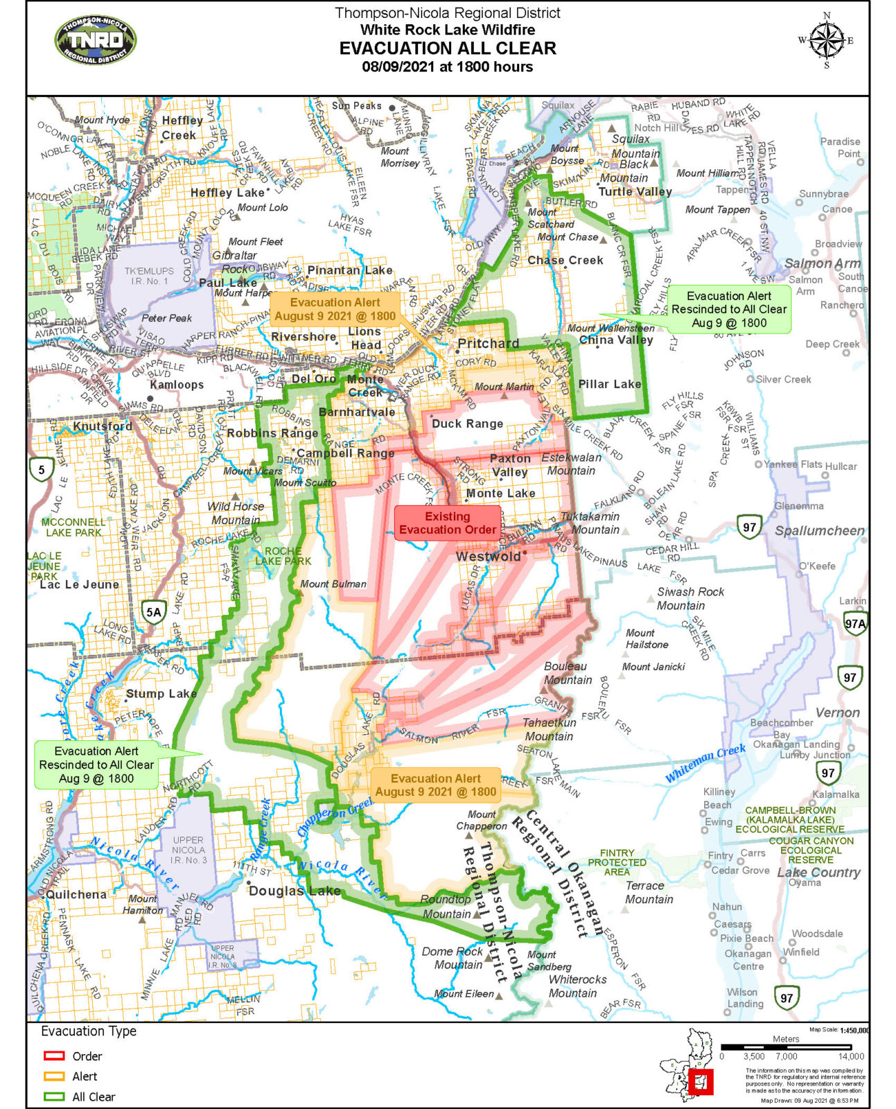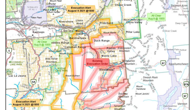
Image Credit: TNRD Evacuation Alert map
Wildfire
Evacuation downgrades around White Rock Lake wildfire
Aug 10, 2021 | 7:20 AM
-
Share on Facebook
-
Share on Bluesky
-
Share on X
- Copy Link
KAMLOOPS – The Thompson-Nicola Regional District (TNRD) has issued a series of evacuation downgrades for communities near the large White Rock Lake wildfire.
Communities on the western and southern edges of the fire within the TNRD have been given the ‘all-clear’. Communities impacted include Douglas Lake to the south and rural Barnhartvale to the west.
The northeastern flank of the fire has also received the all clear. That includes properties along the Chase-Falkland road. The Village of Chase also rescinded its Evacuation Alert earlier today (Aug. 9).
The communities of Monte Lake and Pritchard are under Evacuation Alerts while closer to the fire, Westwold remains under an Evacuation Order.