Get the Top, Local stories delivered to your inbox! Click here to join the daily Vernon Matters newsletter.
Wave crashing over road (Photo 97918569 © Daniel Logan | Dreamstime.com)
2 grant applications

Okanagan Basin Water Board seeks flood mapping funds

Feb 6, 2021 | 9:00 AM

The Okanagan Basin Water Board (OBWB) has submitted grant applications under the National Disaster Mitigation Program, funded by Emergency Management B.C. and Public Safety Canada for two projects worth close to $1 million.

This is the first time the water board, as its own entity, has been allowed to seek the grant.

One is for ‘Flood Risk Mapping’ to add additional information to the lakeshore floodplain maps.

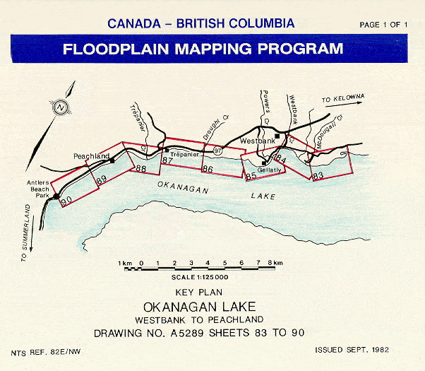
Flood mapping (photo/Province of B.C.)

The other application is for something called ‘Nearshore Bathymetry Mapping’ – topographical maps for the portions of the shoreline that are normally underwater.

Knowing the bathymetry of the lakes helps forecast the risk of wave damage during storms under high water conditions.

An example is what happened at Antlers Beach in Peachland in 2017, when wave action caused undermining of lakeshore retaining material, damaging a section of Highway 97.

OBWB hopes to be notified about the applications by early April, 2021.

There is another grant intake for flood-resilience projects through the Community Emergency Preparedness Fund on Feb. 26.

OBWB is not eligible to apply, they can however assist other communities with an application to the fund.

View Comments