Get the Top, Local stories delivered to your inbox! Click here to join the daily Vernon Matters newsletter.
(File photo/Vernon Matters Staff)
Mild winter is over

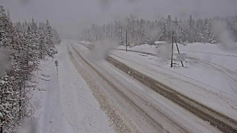
Winter wallop: snow arrives, frigid weather on deck

Jan 9, 2024 | 10:30 AM

The Okanagan is digging out after the first major winter storm of the season.

Snow amounts around the North Okanagan vary, with Silver Star Mountain at the top end and reporting 12 cm’s.

Environment Canada says another 4 to 8 cm’s could fall through Tuesday night.

On the roads, winter storm warnings remain in effect for the Coquihalla Highway from Hope to Merritt, the Hope-Princeton Highway, and for Highway 3 — the Paulson Summit — where further snowfall amounts of 20 to 30 cm’s are expected.

Highway 1 through the Rogers Pass could get a further 10 cm’s.

Meantime, Environment Canada is forecasting a cold snap to move into the Interior Wednesday, and lasting at least through the weekend. Lows could dip to minus 20 on Thursday with daytime highs only reaching minus 15 on Friday.

Winter on its way: snow and frigid weather
Jan. 8, 2024

The Okanagan — and other parts of B.C. — are about to get lots of snow, and it’s also going to get cold.

Environment Canada has issued a snowfall warning for the North, Central and South Okanagan with up to 10 cm expected from today (Jan. 8) until Wednesday. The warning also covers the Shuswap, Similkameen, Manning – Skagit Valley, Boundary and East Kootenay.

Meantime, winter storm warnings are in effect for the Coquihalla, the Connector, the Hope-Princeton Highway and Highway 1 through the Rogers Pass.

Environment Canada says the Coquihalla and Hope-Princeton are both expected to receive 30 to 50 cm of snow over the next couple days while the Connector and Highway 1 could get 15 cm.

The cold weather will move in by mid-week and bring lows down to minus 21 by Thursday, and daytime highs on Friday to minus 16.

View Comments