Get the Top, Local stories delivered to your inbox! Click here to join the daily Vernon Matters newsletter.
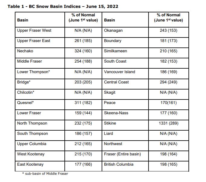
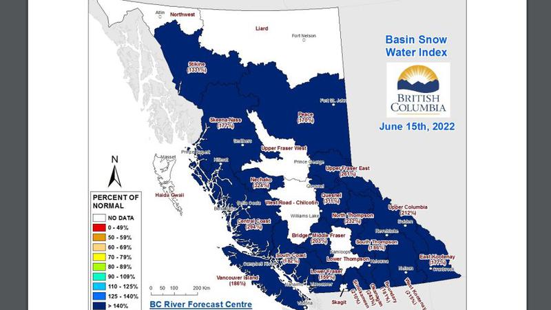
Basin snow water index as of June 15, 2022 (Image credit: BC River Forecast Centre)
Slow snow melt

Okanagan snow pack at 243% of normal

Jun 17, 2022 | 12:56 PM

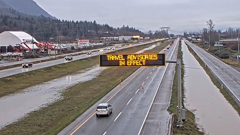
The flood risk remains high around British Columbia due to delayed melt of the mountain snow pack and the unsettled weather conditions.

The B.C. River Forecast Centre’s snow pack report for June 15 shows readings well above normal, with a provincial average of 198 per cent of normal, the average of all snow measurements across B.C.

That’s up from the 165 per cent of normal on June 1.

“All regions of the province with snow measurements have snow basin indices greater than 140 per cent of normal, indicating continued risk throughout the Interior from snowmelt related flooding, especially in combination with heavy rain,” the report stated.

The Okanagan’s snow pack reading is 243 per cent of normal, up from 153 per cent of normal on June 1. The highest readings are in Nechako at 324 per cent of normal and Quesnel at 311.

“Caution should be taken in interpreting the snow basin index values at this time of year as they compare to a normal value that is typically dropping quickly,” the report stated. “It is not unusual to have very high values for June 1 or June 15. This year, five stations measured record high snow values for June 15, including sites in the South Thompson, Upper Columbia, and West Kootenay.”

The provincial agency said the snow melt is two to four weeks behind schedule this year, largely due to the cooler weather this spring.

The centre stated about 75 per cent of the snow accumulation from the winter has typically melted by June 15. This year, the proportion is closer to 50 per cent.

The bulletin notes the delay has resulted in the freshet flood risk extending into late July for the largest river systems in the province.

(Image credit: BC River Forecast Centre)
View Comments